

You can find on this page a map showing Rio de Janeiro boroughs and a map presenting Rio de Janeiro neighborhoods. Rio boroughs & districts called Município are the administrative divisions that share Rio de Janeiro in 33 municipal boroughs. Within each of its boroughs, the neighborhoods are making the charm and the reputation of the city of Rio de Janeiro.
Rio de Janeiro with its more than 6 million inhabitants is the second largest city in Brazil after Sao Paulo. Discover on this page the maps of the districts of Rio de Janeiro and their presentation.
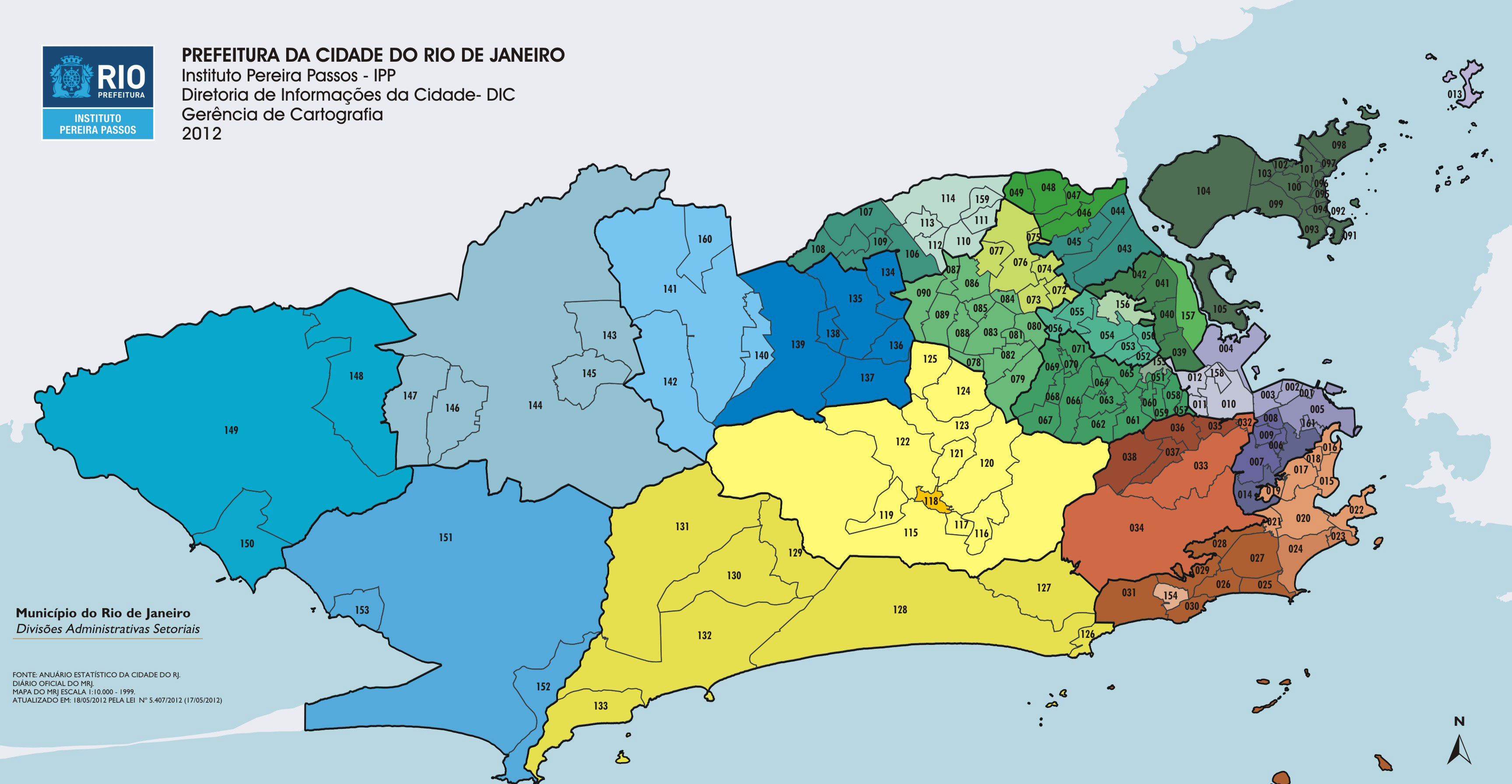
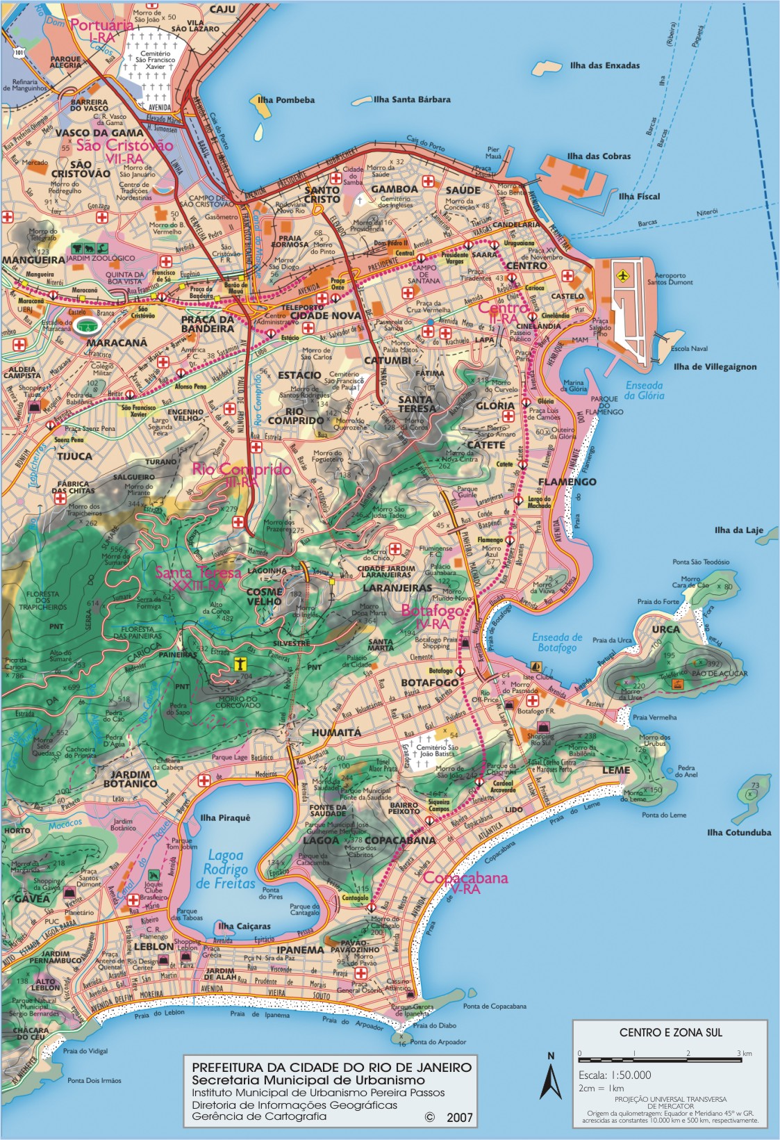
The division of Rio de Janeiro into 33 boroughs or districts is divided into 4 zones: the Downtown and South Zone which are the most touristic and the North and West Zone. For Downtown we have the following neighborhoods: Bairro Imperial de São Cristóvão, Benfica, Caju, Catumbi, Centro, Cidade Nova, Estácio, Gamboa, Glória, Lapa, Mangueira, Paquetá, Rio Comprido, Santa Teresa, Santo Cristo, Saúde, Vasco da Gama whereas for the South Zone we have the following neighborhoods: Botafogo, Catete, Copacabana, Cosme Velho, Flamengo, Gávea, Glória, Humaitá, Ipanema, Jardim Botânico, Lagoa, Laranjeiras, Leblon, Leme, Rocinha, São Conrado, Urca, Vidigal.
Rio de Janeiro reputation is made by its diverse neighborhoods, in which you will find Rio beaches or cultural venues.
These include:
Rio de Janeiro is a city of contrasted urbanism. Rio is divided into 4 large areas (North, South, Centre and West) and numerous neighbourhoods. Each neighborhood in Rio forms distinct population and cultural groupings with significant social inequalities.
Each of Rio's neighbourhoods was built at different times in the city's history. The Downtown, built during the Colonial era, is the oldest, while the West Zone is the most recent.
In Rio de Janeiro, you can go from very rich neighborhoods near the ocean (Copacabana, Ipanema, Leblon) to very poor neighborhoods, sheltering the favelas that cling to the city's mountains.
The Downtown district is more diversified: shops, offices, skyscrapers but also colonial buildings.


