

You can find on this page the map of Rio de Janeiro suburban train. The Rio de Janeiro urban, suburban & communter train is a transit system serving the city of Rio de Janeiro (Brazil) with the subway, the tram, the bus or the ferry. The commuter train network has 8 lines and 146 stations forming a rail network of 156 miles (252 km).
SuperVia has been managing train lines in Rio de Janeiro and its region since 1998. SuperVia manages 8 train lines and 103 stations in Rio de Janeiro covering a region from the North (Guapimirim) with a stop in Guapimirim to the South (Paciência) with a stop in Tancredo Neves. The westernmost stop is Paracambi and the easternmost stop is Guapimirim.
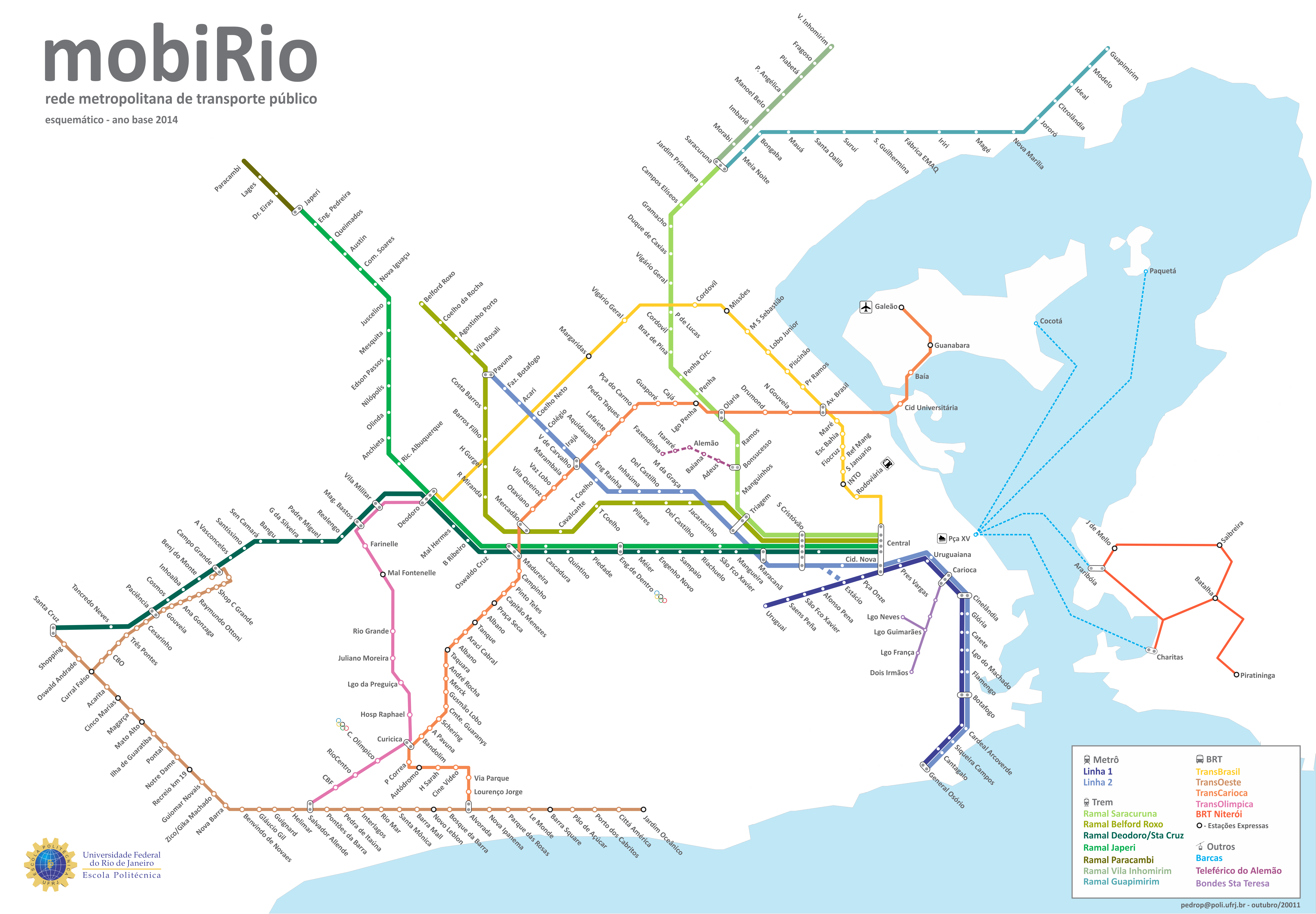
Rio de Janeiro trains which transport 125 million passengers per year, exist since 1998 and are operated by the SuperVia Concessionária de Transportes Ferroviários.
Its network includes the following 8 lines:
SuperVia has train lines through Rio de Janeiro and its region:
SuperVia Trens Urbanos is a rapid transit and commuter train operator that carries about 750 million passengers per year on a rail network of 104 stations in 12 cities (including Rio de Janeiro).


